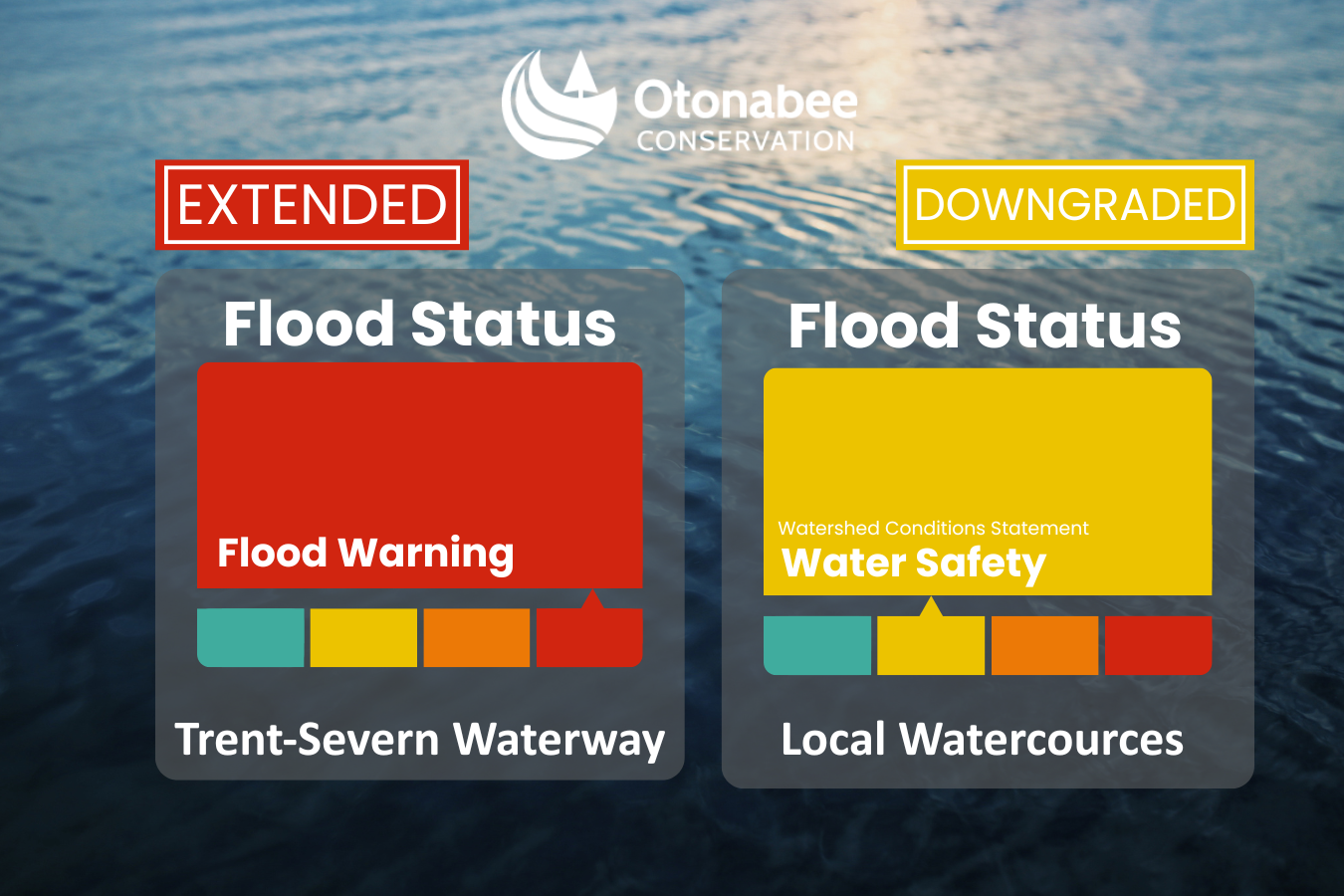
FLOOD WARNING and WATERSHED CONDITIONS STATEMENT – WATER SAFETY statement
Message # 2026-12
Issued: 10:00 am., Thursday, April 23, 2026
FLOOD WARNING - has been extended for the Trent-Severn Waterway in the jurisdiction of Otonabee Conservation
WATERSHED CONDITIONS STATEMENT – WATER SAFETY has been downgraded from a FLOOD WATCH for local watercourses within the jurisdiction of Otonabee Conservation
As water levels and flows on local watercourses within the Otonabee watershed begin to recede, high volumes of water from the Haliburton Reservoir Lakes region continue to be managed through the Trent-Severn Waterway, including the Kawartha Lakes, Otonabee River, Rice Lake, and the Trent River to Hastings. Over the next few days, water levels are expected to stabilize, while flows will remain hazardous.
Fast-moving, cold water combined with slippery or unstable shorelines continues to pose a significant safety risk. Otonabee Conservation strongly advises the public to avoid all activities near watercourses.
Residents along local watercourses—particularly in low-lying areas—are encouraged to closely monitor conditions and take necessary precautions to protect themselves and their property from ongoing or potential flooding. Stay informed by monitoring weather updates and water levels, or subscribe on our website to receive flood messages directly.
Water levels can be monitored on-line at:
1) Trent-Severn Waterway’s Water Management InfoNet
2) Water Survey of Canada Real-Time Hydrometric Data
3) Otonabee Conservation website
This FLOOD WARNING and WATERSHED CONDITIONS STATEMENT – WATER SAFETY message will expire Thursday, April 30, 2026, at 3:00p.m., unless updated earlier.
-30-
Neil MacFarlane | Flood Forecasting & Warning Duty Officer | 705-745-5791 x 231
250 Milroy Drive, Peterborough, ON K9H 7M9 |
Subscribe to our News
Stay up to date on Otonabee Conservation's activities, events, programs and operations by subscribing to our News.