How To: PIC Mapping Interface
How To Use Mapping / Commenting App
Please be advised the mapping app is best viewed on a desktop computer or large screen. It is not recommended for use on your phone or other mobile device.
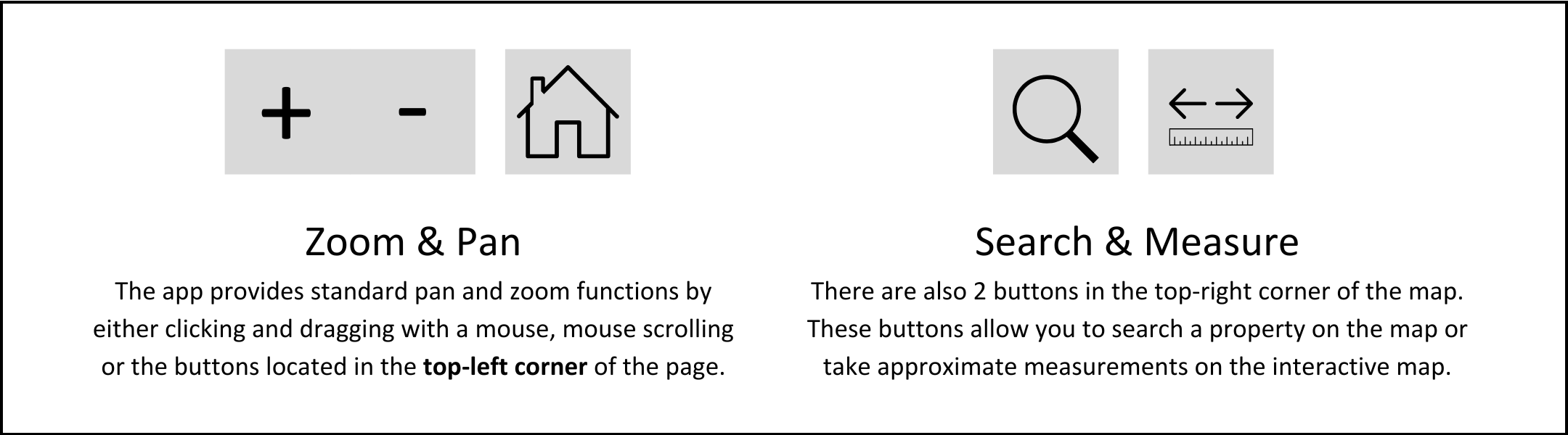
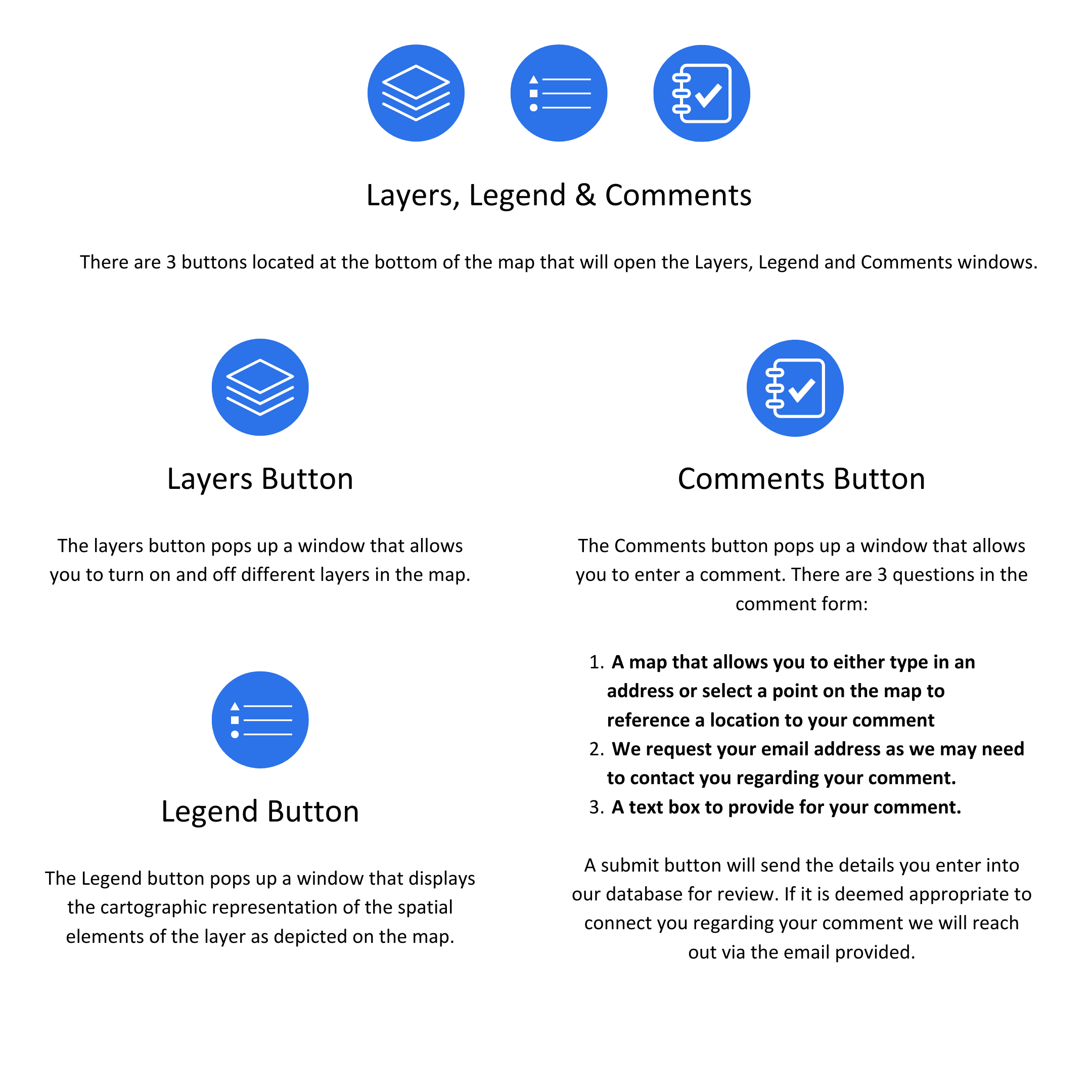
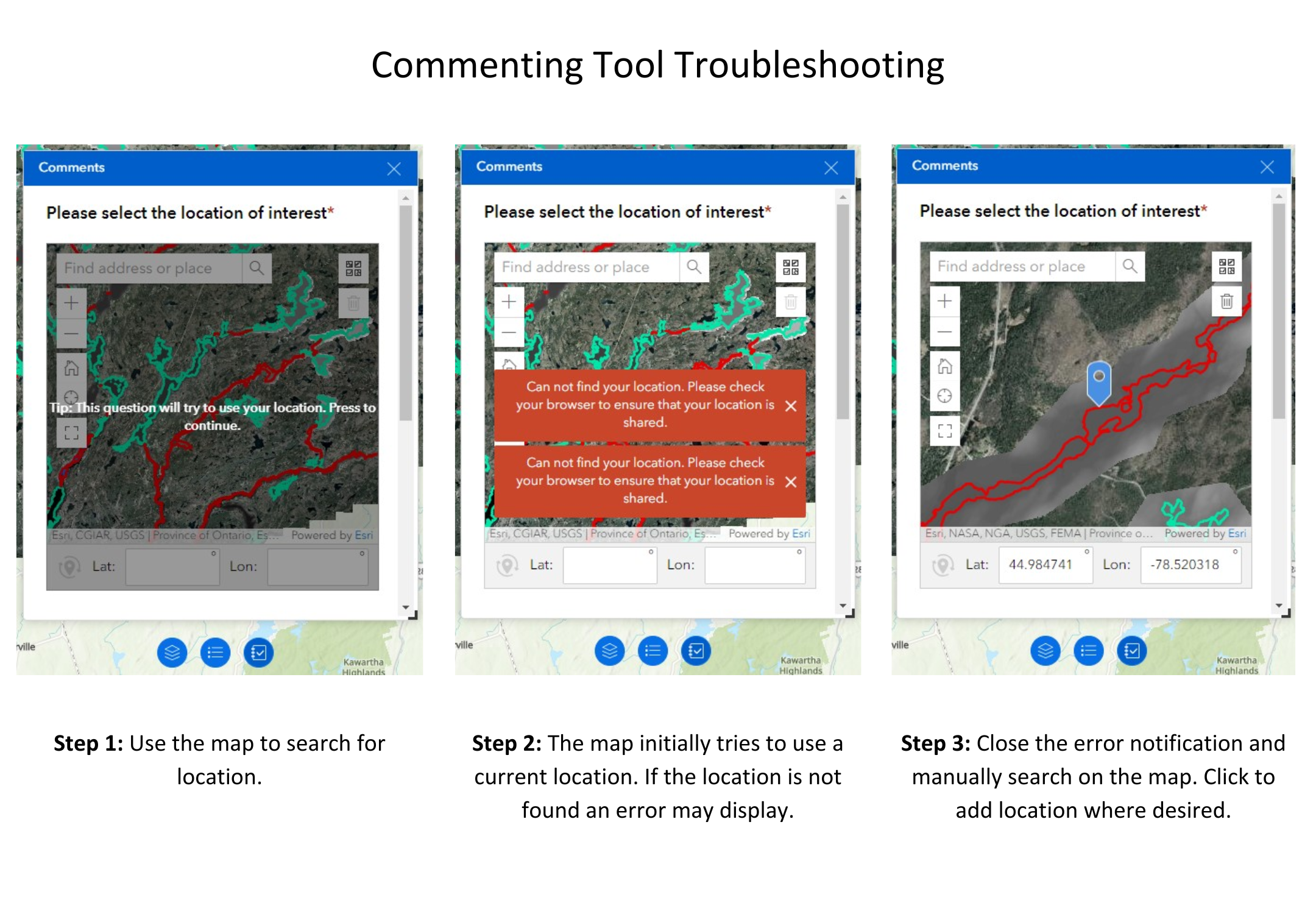
Functionality
The commenting app was developed to allow members of the public to provide comments on the draft flood lines developed during this project.
Contact Us
250 Milroy Drive
Peterborough, ON K9H 7M9
Voice: 705-745-5791
Fax: 705-745-7488
Email: otonabeeca@otonabeeconservation.com


Use the interactive map interface or EMAIL us directly
Subscribe to our News
Stay up to date on Otonabee Conservation's activities, events, programs and operations by subscribing to our News.